SUSTAINABLE URBAN LANDSCAPES
Alternative
Development Standards
for Sustainable Communities
for Sustainable Communities
Community Context
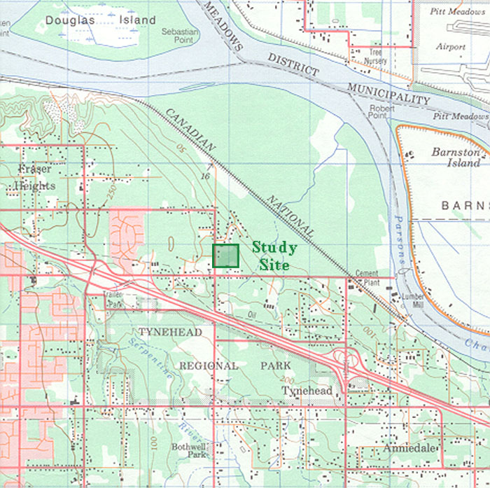
| A topographic survey map placing the Status Quo Pattern study site within its community context. On this map urbanized areas are shown in pink, forests in green, and agriculture and open space areas in white. The Fraser River to the north and east is bordered by a wide, wooded flood plain which forms the edge of the Fraser Heights community. The area immediately around the study site is drained by a creek which feeds into the Fraser River. The Trans Canada Highway lays to the south-west and effectively separates the study site from the body of Surrey's urban zones. One-hundred-sixty-eight Street forms the western border of the site while 104 Avenue lies close to the southern edge of the site. The 0.03 square kilometre (7.4 acre) study site is demarcated by the green rectangle. |
 |