SUSTAINABLE URBAN LANDSCAPES
Alternative
Development Standards
for Sustainable Communities
for Sustainable Communities
WITH ECOLOGICAL UNDERLAY
Neighbourhood Context
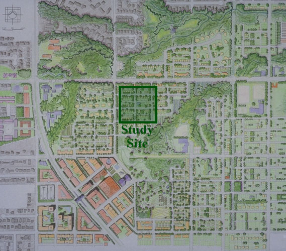
| Illustrative plan from the Sustainable Urban Landscapes design charrette for the neighbourhood surrounding the Traditional Pattern with an Ecological Underlay site. In this proposal commercial uses are shown in light red, high-density housing is shown in orange, low-density housing is shown in yellow, and public and civic buildings are shown in blue. The commercial and high density housing centre is located at the lower left (the southwest) corner of the site. The centre is built around a proposed transit station on King George Highway. A neighbourhood grid of narrow streets and lanes has been integrated with the existing pattern of highways, rural roads, and rectangular lots. This grid gives way when confronted with the natural stream areas. The major east-west connection through the middle of the site, 62nd Avenue, becomes a pedestrian and bicycle route. The stream areas provide a natural storm-drainage system and a framework for neighbourhood civic and recreational facilities. Neighbourhood schools, daycare centres, and play areas are located within the natural areas at the centre of the site. The 0.03 square kilometre (7.4 acre) study site is demarcated by the green rectangle. |
 |