SUSTAINABLE URBAN LANDSCAPES
Alternative
Development Standards
for Sustainable Communities
for Sustainable Communities
Community Context
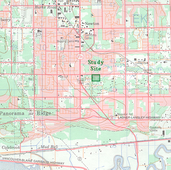
| A topographic survey map placing the Traditional Pattern with an Ecological Underlay study site within its community context. On this map urbanized areas are shown in pink, forests in green, and agriculture and open space areas in white. The Serpentine and Nicomekl Rivers, to the east and south of the site respectively, are bordered by wide agricultural flood plains. These flood plains divide Surrey into three distinct upland urban zones: (1) the Newton/Whalley/Guildford urbanization, to the immediate north of the Status Quo Pattern study site, (2) the Cloverdale District, ten kilometres (6.2 miles) due east of the study site, and (3) South Surrey, 7 kilometres (4.3 miles) due south of the study site. The study site sits within the southern portion of the community of Newton. This part of Surrey is drained by the Hyland Creek and its tributaries. Several of Hyland Creek's smaller tributaries are located along the southern border of the site. King George Highway lays west of the site while 64th Avenue lies close to the northern edge of the site. The 0.03 square kilometre (7.4 acre) study site is demarcated by the green rectangle. |
 |