|
Example
1
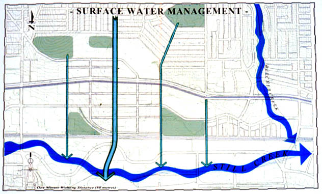
The
sloped topography and surficial geology of the site are characteristics
favourable to infiltration devices such as channels, swales, buffers,
and wetlands (shown here in Team Three’s concept for Surface Water
Managment). Smaller swales running along local
roads feed into the primary channeling system, represented by
the thick lines running along the major north-south arterials. Example
2
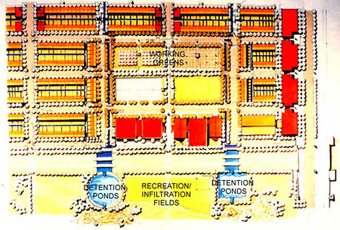
Team
One considered streets and rear lanes as an organizing structure
for surface water management. Water channels flow into larger
north-south swales and provide irrigation for the central working
greens (shown at the centre of the image at left). These
greens would serve a number of social, ecological, and recreational
functions for the neighbourhood and would act as infiltration
basins during storm events. 
|
|