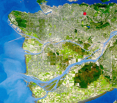
The
Lower Mainland Region of British Columbia as seen from
space (this and all other plan views in this document
are shown with north up). Urban development is influenced
by the region's unique geography. Located on the Pacific
Rim, the region is bisected by marine inlets and the Fraser
River delta. The city of Vancouver occupies the peninsula
at the extreme left, bounded by the Burrard Inlet on the
north and the Fraser River on the south. The city of Burnaby
lies just east of Vancouver. The Brentwood site (shown
by a red circle) lies in the Central Valley between two
prominent ridges. This wide, shallow valley is part of
the Brunette Watershed and contains a number of important
and sensitive waterbodies including Deer Lake and Burnaby
Lake (appearing as the large open space directly east
of the site), as well as Still Creek and the Brunette
River.
 Back Back
 |
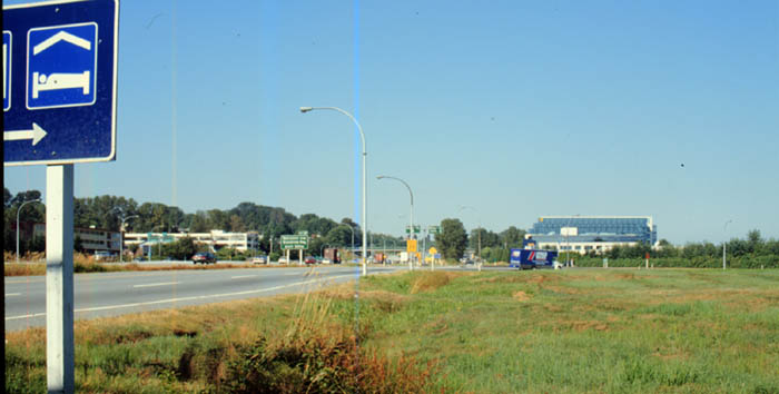
The
Trans-Canada Highway traverses the southern edge of the
site. Levels of commuter traffic along this route have
increased due to an increasing rate of suburban expansion
in municipalities to the east of Vancouver. Business parks
and light industry, attracted by available land and vicinity
to transport linkages, are located on both the north and
south edges of the highway.
Back
 |
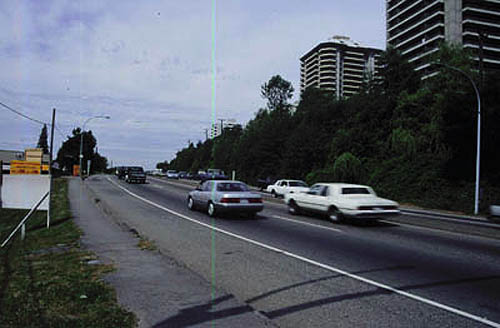
Lougheed
Highway looking west. High-density apartments are located
adjacent to this high-traffic corridor with single family
zones tucked further back. The residential areas are buffered
from the highway by a stand of 2nd growth deciduous forest.
Back
 |
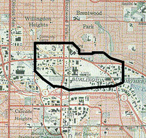
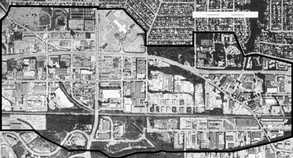
A
topographic survey map showing the study site in its context.
The 590 acre Brentwood site is shown with a black outline.
Willingdon Avenue and Lougheed Highway intersect the site,
and to the south is the Trans-Canada (# 1) Highway. The
Lougheed and Trans -Canada are two of the regions most
heavily used east-west commuter routes. Another important
transport route, the Burlington Northern Santa Fe Railway,
can be seen bisecting the southern portion of the site.
Back
 |
Air
photo showing the 590 acre site. The large area of grey
at the top of the site is Brentwood Mall. Light industry
and auto-oriented commercial lines Lougheed Highway and
fills in the middle of the site. The site rests
entirely within the Brunette Watershed and contains several
natural features identified in the GVRDs Green
Zone. Of these important areas are the significant stand
of 2nd growth forest at the mid-eastern edge of the site,
the Beth Israel Cemetery in the north-western corner,
and the Still Creek corridor to the south.
Back
 |
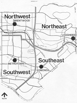
The
Livable Region Strategic Plan supports the development
of communities focused on town centres throughout the
region. As complete communities these centres would provide
a balance of jobs, choice of affordable housing types,
better distribution of public services, and more effective
transportation. Four town centres have been identified
for Burnaby: Brentwood, Lougheed, Edmonds, and Metrotown
- the Regional Town Center for Burnaby.
Back
 |
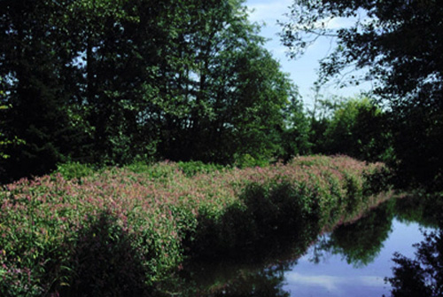
Still
Creek is one of the last remaining original fish bearing
streams in the Vancouver area. Beginning near Central Park
(to the northwest of the site), the partly culverted stream
passes through residential and industrial lands in both
Vancouver and Burnaby before it drains into Burnaby Lake.
Polluted runoff from impervious surfaces is a major threat
to its health.
Back
 |
|
|