Illustrative Site Plan
|
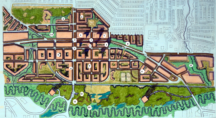
High-density residential point towers (1) sit atop the podiums of commercial uses that line Lougheed Highway (2) and the transit-focused High Street (3). To the south, Brentwood Mall is replaced by a variety of housing types including: medium density, ground-oriented (4 and 5); and low-rise apartments (6). This area would be connected to the retail and transit hub by a pedestrian bridge (7) that crosses Lougheed Highway, which is aligned with the pedestrian-focused green street. Entry into the town centre is announced at either end by large blocks of deciduous forest (8), which assist in ecologically linking the upper portions of the site with Still Creek to the south. The middle of the site is dominated by medium-density residential neighbourhoods that feature four-storey courtyard buildings (9) stepping down the slope. The restored Still Creek corridor (10) has a tighter meandering stream course and an extensive forested edge (11) that provide both wildlife habitat and opportunities for linking up with the existing urban trail system (12). Beecher Creek (13), and historic Brentwood Creek have been daylighted and drain into Still Creek on either end of the site. |
||||
 |